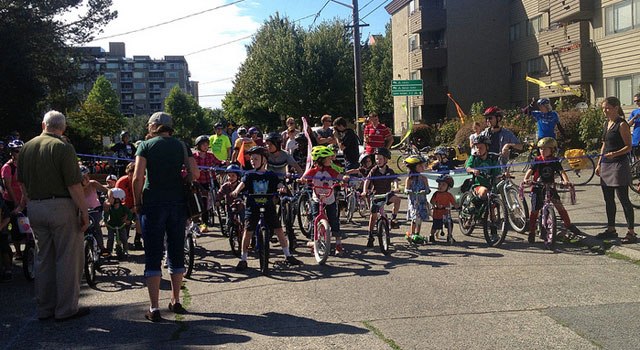
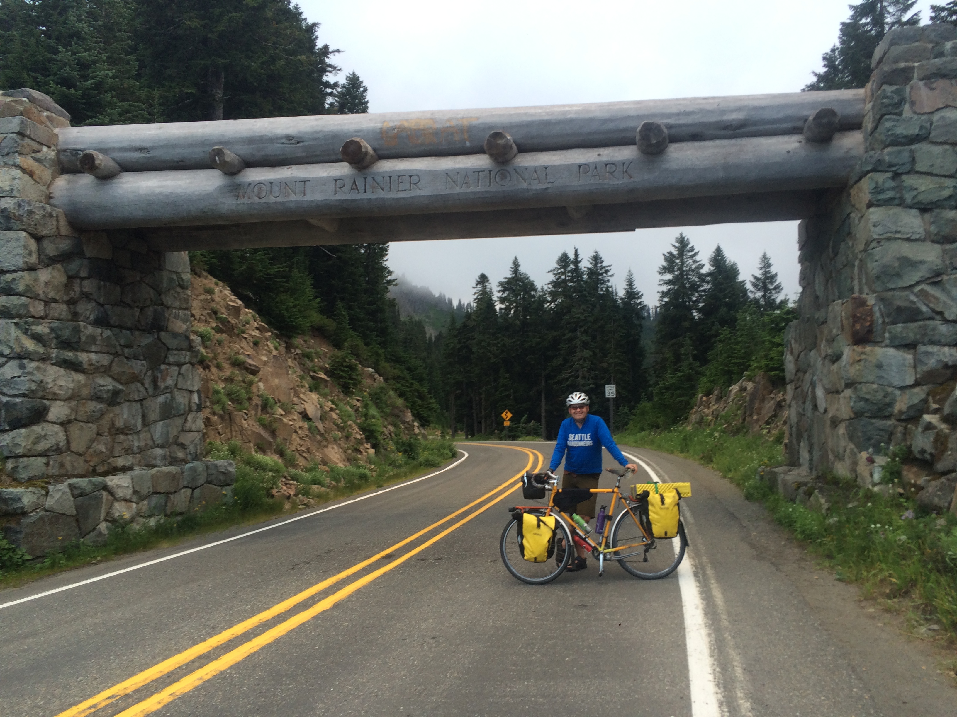
My friend Brad and I had some overlapping kid-free days so we left our Big Dummies and tandem bikes at home for a multi-day bike tour on single-occupant bikes. I’d never done multi-day/multi-site bike camping, and last year marked the first time the kids and I camped for more than just one night period (on Vancouver Island over Spring Break and at Fay Bainbridge Park in August).
Here’s the photo album: Three days around Mount Rainier (and to Mount St Helens) with Brad (435 photos).
And here are my Strava recordings of the trip to see the route:
- Day one: 85.6 miles, 7:47:36 moving time, 6,593 feet gained
- Day two: 109.3 miles, 11:43:18 moving time, 10,663 feet gained
- Day three: 114.1 miles, 9:31:59 moving time, 4,057 feet gained
Brad and I usually ride with our four respective kids–like when we went bike camping at Manchester State Park last month. This trip was very different. I’ve known Brad for years through family biking, but he’s also a randonneur so I should have realized going into our trip that it would be really hard. Note to self: no more bike touring with randonneurs–it’s too hard! That said, it was also really fun, and I’m glad we went. But I’m glad we ended up coming home a day early and I’m REALLY glad we cut out two of the mountain passes Brad had planned. I feel a great sense of accomplishment at our miles and elevation biked, and the scenery was spectacular, but the best part was the people we met along the way.
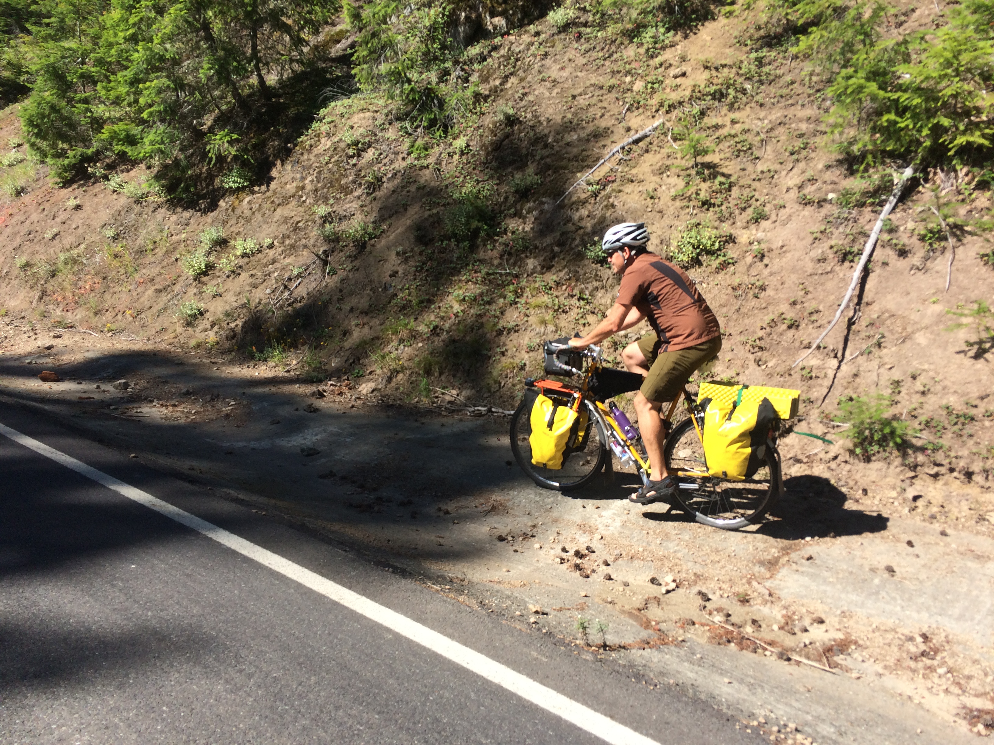
Brad plotted our route, including checking with other randonneurs about the status of washed-out roads, plus he was familiar with a lot of the area thanks to Seattle International Randonneurs events. So I just answered “yes” to any route questions posed to me, let all the details go in one ear and out the other lest the number of miles or mountains intimidate me, and blindly followed along. Now, I love leading rides and planning routes, but it’s so nice to take a break and not do any thinking about things every once in a while! He mentioned taking the bus to cut out the “boring miles” and get out of the city faster so that meant I had to take my road bike, since the front rack and basket on my Surly Straggler mean it doesn’t fit on the bus rack. I knew from a recent trip to Veneta, Oregon (which I hope to at least post photos of soon, if not also do a little blog recap) that I could fit my camping gear on my road bike. And I was happy to have my lightest bike along for the big ride, though that meant no room for Pixie so I left her behind with a friend.
My bike:

2006 Specialized Dolce Elite road bike with:
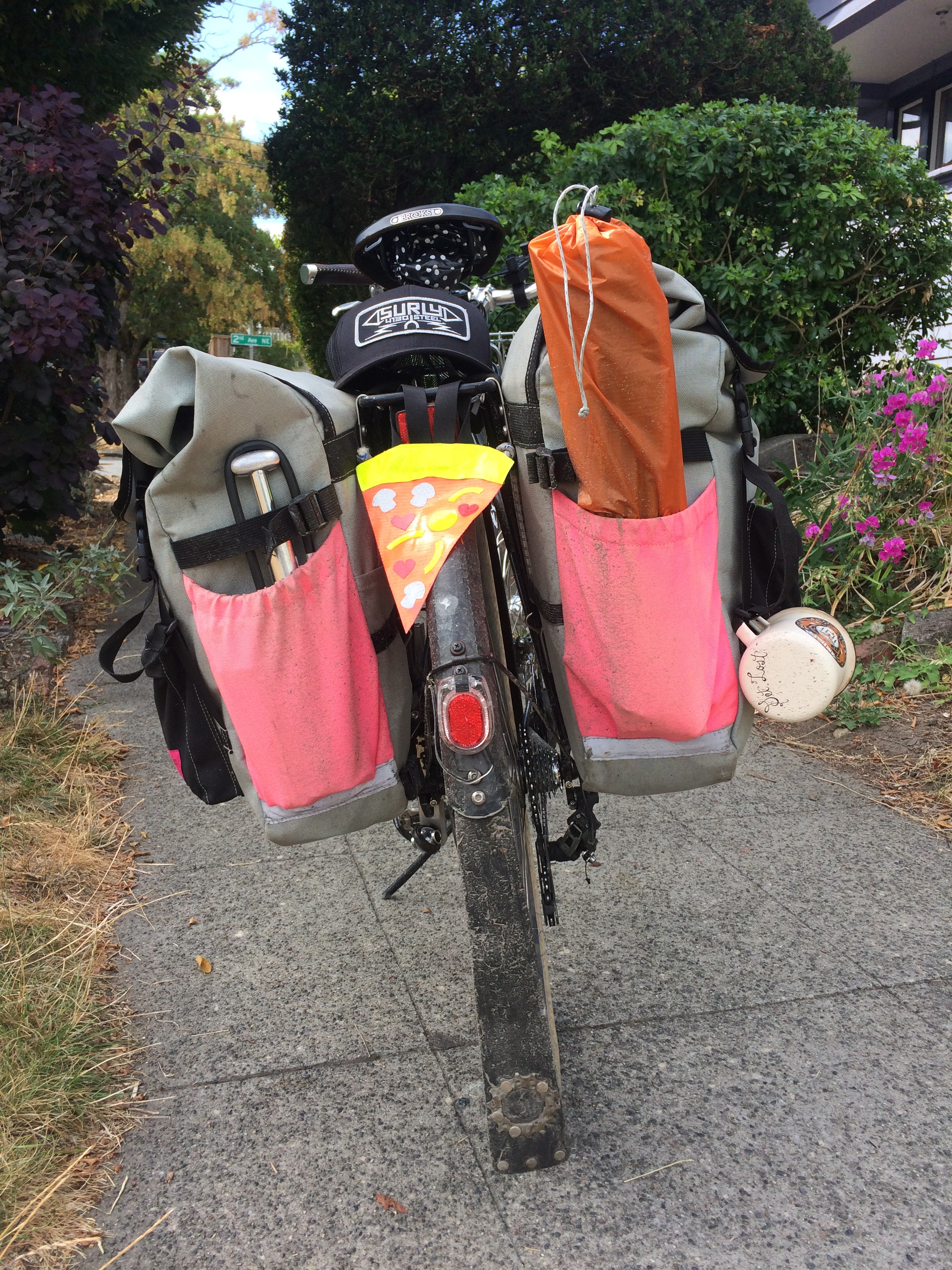
- Swift Industries large Zeitgeist saddle bag containing my tent, sleeping pad, pillow, water filter, sun screen, mosquito repellent, toothbrush, toothpaste, small towel, and lantern on the inside; sleeping bag, bag of snacks, flip flops, coffee mug, pump, tent poles on the outside
- Swift Industries Paloma handlebar bag containing snacks, bike lock, tools, spare tube, wallet, thin wool long-sleeved shirt, thin cotton long-sleeved button-up shirt, and external battery that holds seven iPhone charges on the inside; rain jacket strapped to the outside
- Oveja Negra small 1/2 Pack frame bag containing one change of clothing
My tires are 700c x 25mm at 110psi (max tire pressure is 120psi) and they proved uncomfortable on the miles and miles of bumpy chipseal. Perhaps the aluminum frame (versus steel) added to that, but it was probably more about my tires. My Surly Straggler’s (steel, btw) tires are 700c x 38mm and I keep them at 30psi. Big difference! But with that bike come two big panniers and a front basket and I tend to shove as much stuff as I can in all that room so it would have been much heavier.
Brad rode his Surly Long Haul Trucker with four panniers (two of which started out empty), a small frame bag, and a handlebar bag. He offered to carry a bunch of my stuff so I could better keep up, but I don’t think the small weight of my gear made any difference–I’m a much slower rider than him in general. But still, I let him carry increasingly more stuff: rain jacket on day one; rain jacket and sleeping pad on day two; rain jacket, sleeping pad, bag of extra snacks, and tent poles on day three. Had we kept our day four, I’m sure I would have ported over all my stuff.

Day One:
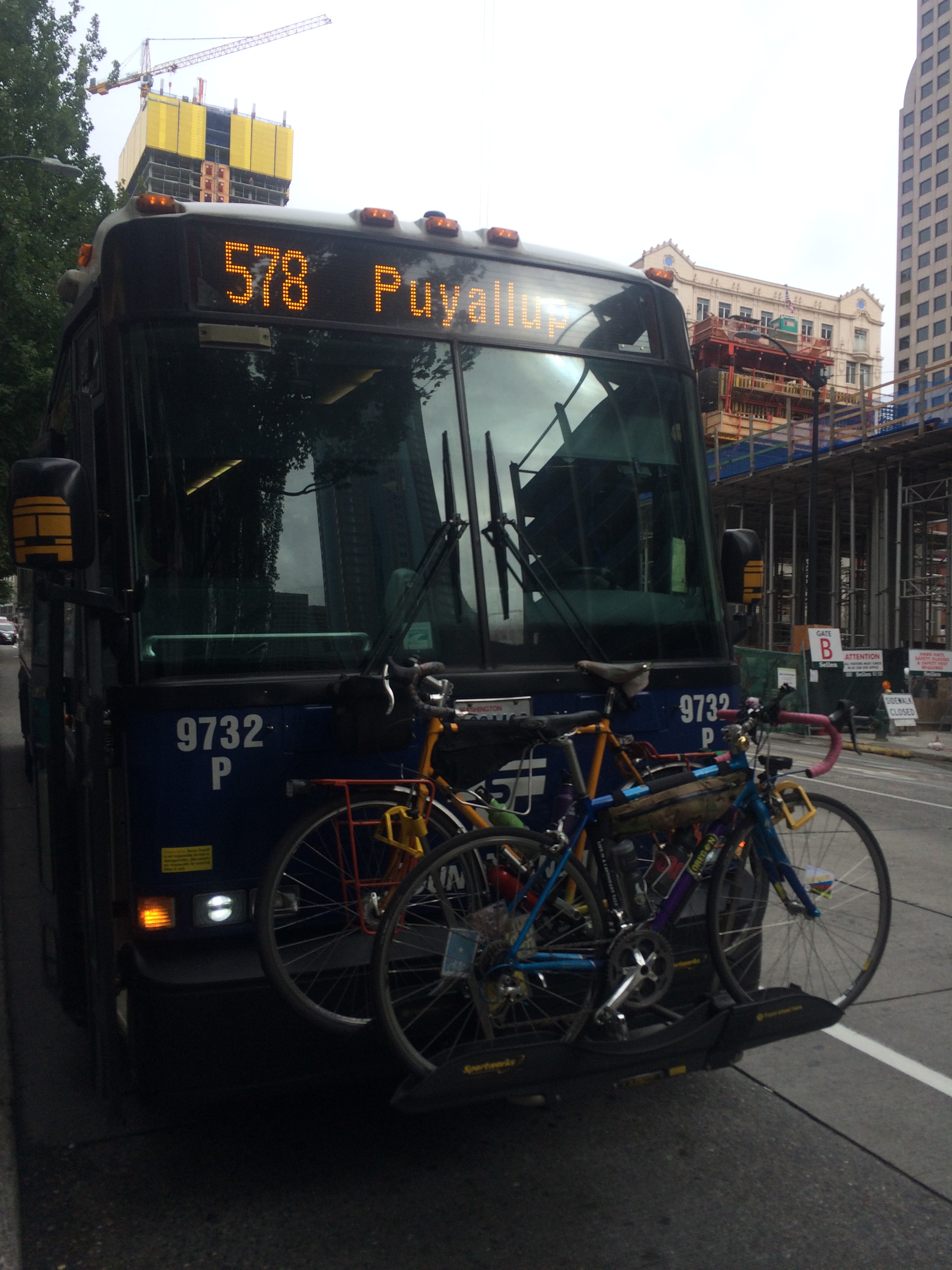
Taking the bus (Sound Transit 578) to Auburn cut out 20 miles. We cut through the Seattle Center (Space Needle!) to get to the bus stop so at least I got a good little dose of city riding, since that is my thing after all. While most Seattle area buses have three-bike racks (all King County Metro and most Sound Transit buses can carry three bikes, I think), the 578 had a two-bike rack. So we were lucky there wasn’t already a bike on board.

It was fun to recognize a couple places from my first big bike overnight, the Swift Campout to Ipsut Creek. First up was Enumclaw-Black Diamond Road, though Brad and I took it in the easier direction, and at the beginning of our day. Then we stopped for lunch at the Safeway in Enumclaw, our return lunch stop of the Swift Campout.
And this is where we made our first friend of the tour, Claire from Seattle, who had biked all the way from Capitol Hill on an old Schwinn mixte with a backpack and no firm plan, other than to take a few days to explore around Mount Rainier. We bumped into her two more times over the course of the day so that was really fun.
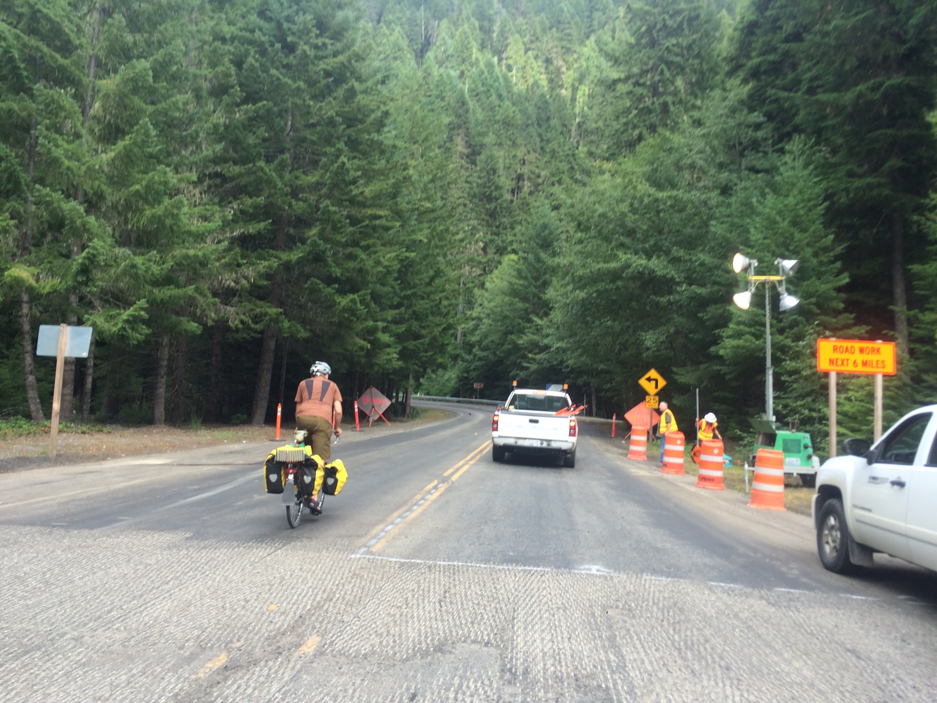
We took a look at summiting Crystal Mountain. I’ve never been there in the winter (I’ve been to Stevens Pass once and Summit at Snoqualmie a bunch of times) so it sounded exciting, especially since we could ride the gondola at the top. But there was no way we could bike to the top (six miles) in the hour before the gondola closed due to intermittent road closures for construction. However, we could have made it up in time were we able to catch a ride in the back of the construction truck. The friendly construction worker checked with her boss if it was OK to give us a lift up the mountain, but unfortunately she didn’t have enough time before the tar arrived at 5pm. Oh well. It was a fun almost-plan!

Our next almost-peak was Sunrise, but with so many clouds in the sky, we weren’t sure we’d see Mount Rainier. So we biked down down down to the White River Ranger Station to check the conditions. Brad said the park ranger would be able to tell us about visibility, but the gate and ranger station were already closed so we flagged down a passing car to ask some fellow park visitors. Conditions were spotty so we decided to skip seeing the sunset at Sunrise. But we did learn that restrooms are now called “comfort stations” and we saw Claire for the last time as she arrived to camp at White River Campground.
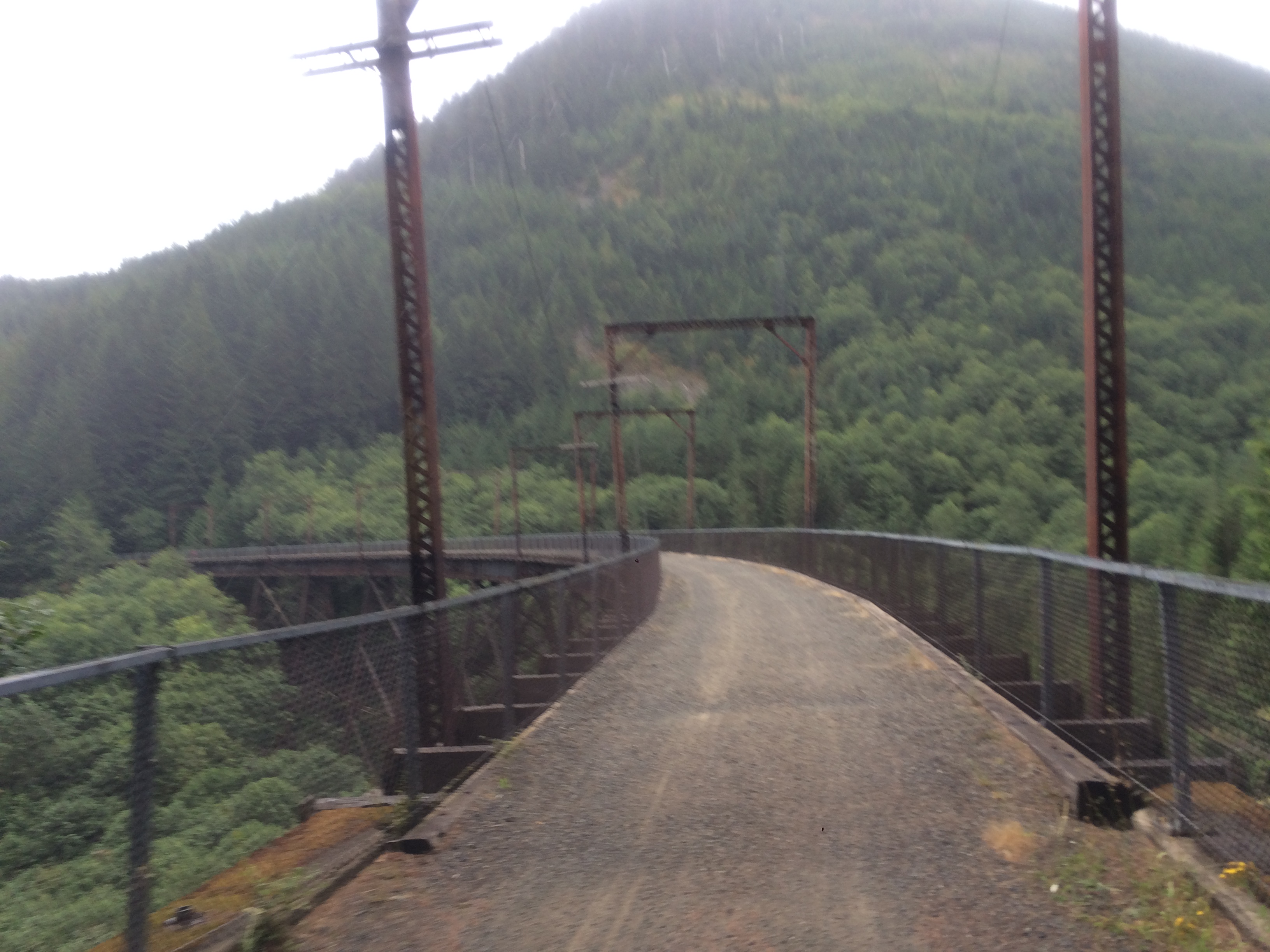
So we biked up up up to the top of Chinook Pass. It was exciting to see the first bit of snow–proof that we were up high in the mountains! And I saw one marmot close to the top, but I didn’t get a picture of him. And then we biked down down down to Ohanapecosh Campground.

The descent from Chinook Pass to Ohanapecosh was ridiculous! You know when Bugs Bunny falls down a hole and screams and flails for a long time and then gets bored of screaming and flailing so he sits in an easy chair and reads the paper…and then he makes a cup of tea…and then he yawns and puts on his jammies, sets the alarm, and goes to sleep…and then the alarm goes off and he jumps up and starts screaming and flailing again? It was like that. Sooooo loooooong.
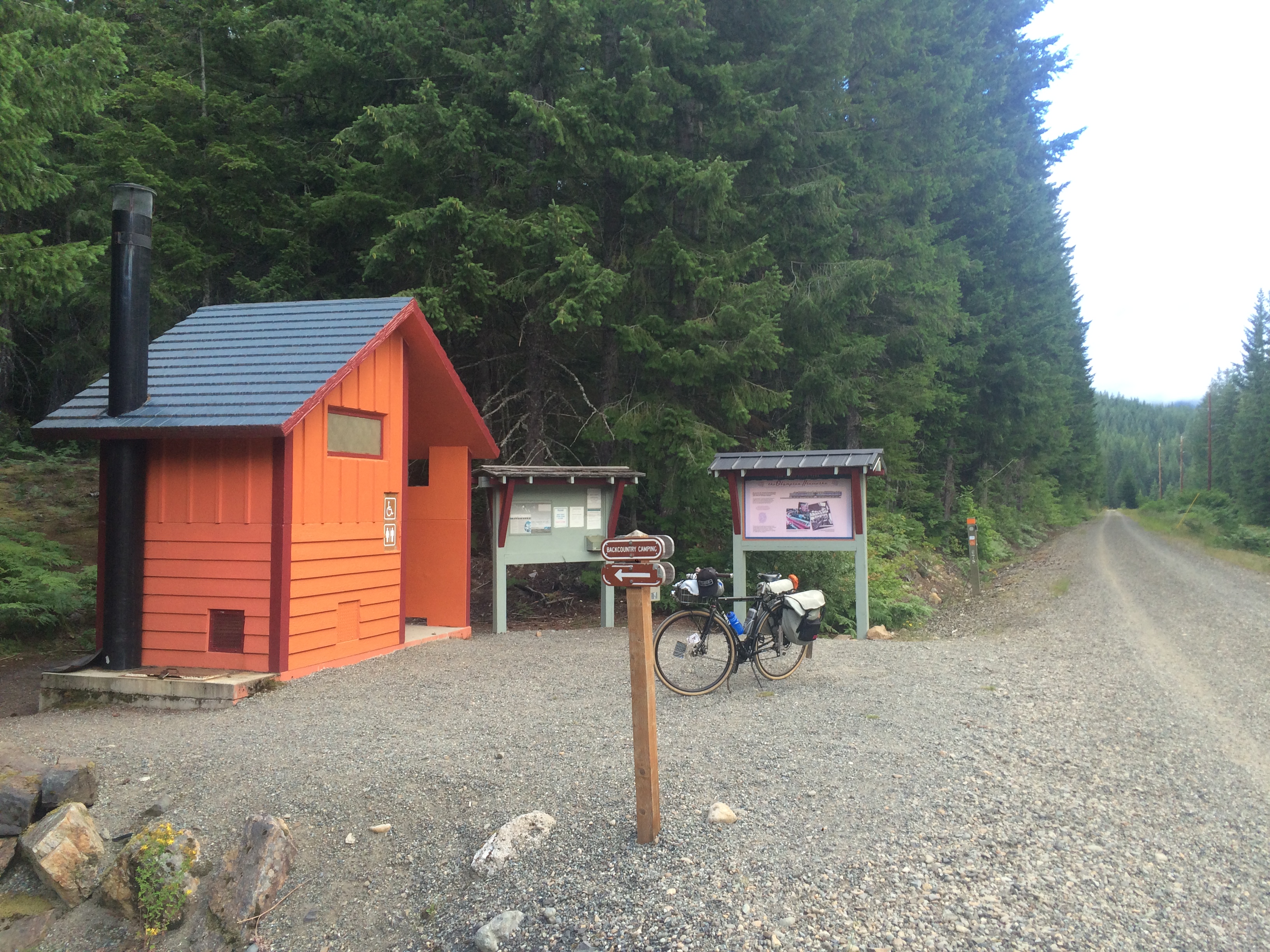
Ohanapecosh was a great campground! We arrived at night and chose a walk-in site, which is not like the hiker/biker sites I’m used to, but rather means you park your car in a parking lot and walk a few extra steps to your site. And the walk-in site area doesn’t have a bear box like the other areas do so we stashed all our food in one pannier and stuck it in the bathroom, not having a bear-proof vehicle like everyone else. This would definitely be a great campground to rent a car and come to with the kids (or bike to when we’re all up to this long of a journey). The visitor center was great as was the variety of programming in the amphitheater.
Day Two:
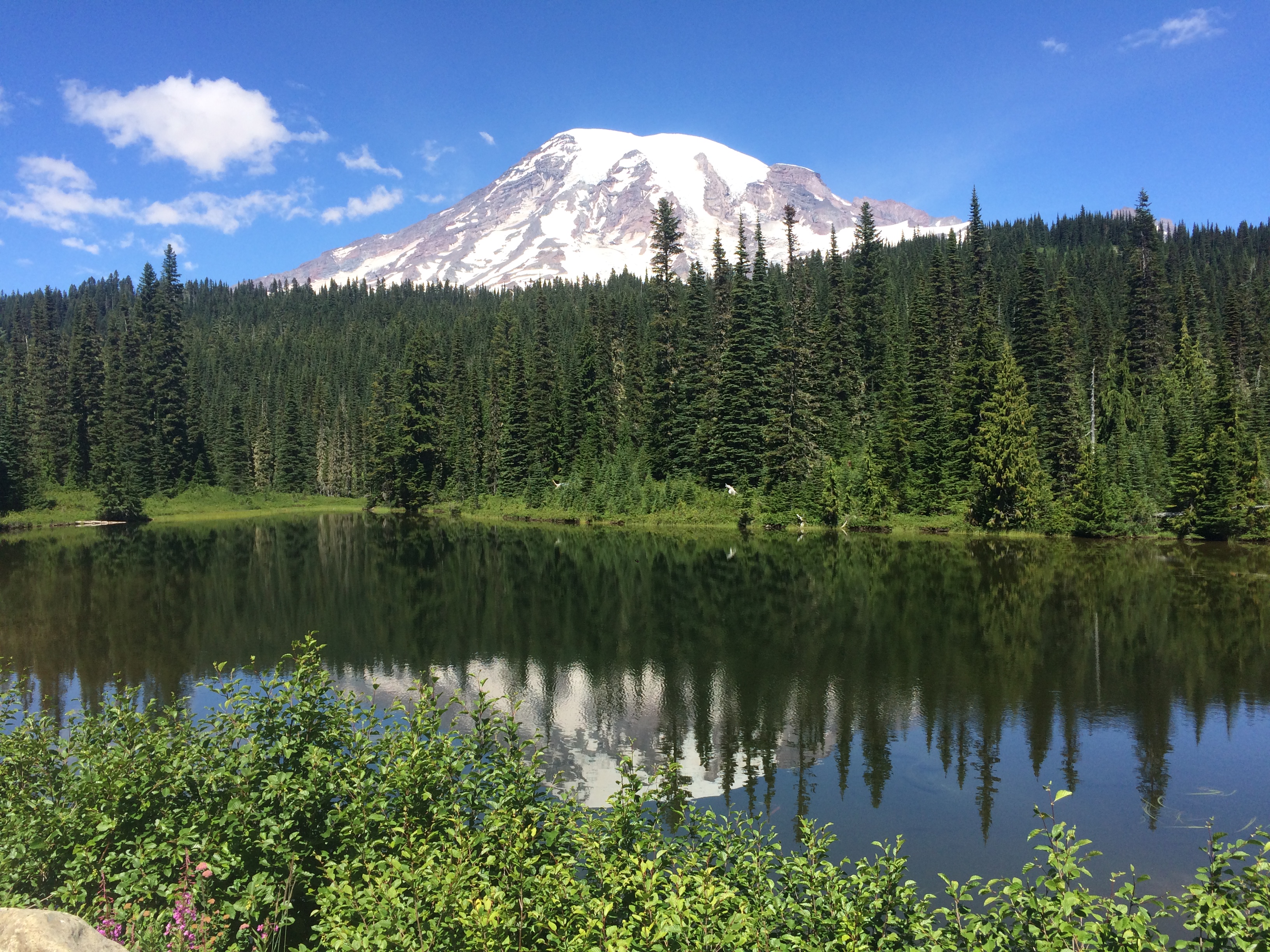
We started our day with a long climb to Paradise. I’ve been once before, but by car, so it was really exciting to arrive by bike!
It was a long, slow ride, but filled with tremendous views. The first of the three Reflection Lakes reflected Mount Rainier perfectly, though someone piloted a drone low over the lake, creating ripples.

On the way up, we stopped to let a mom and daughter cross the road from the Cowlitz Divide Trail. We stopped to talk and learned the mom is a tribal leader of the Cowlitz Tribe and in the space of ten minutes, we learned a ton of history. Here’s a tidbit for you: the Cowlitz word for Mount St Helens is Lawetlat’la.
It was also neat to use Strava FlyBy to identify and “give kudos” (that means clicking the thumbs up on someone’s Strava recording) to the fast guy who passed us as we crawled up Paradise.

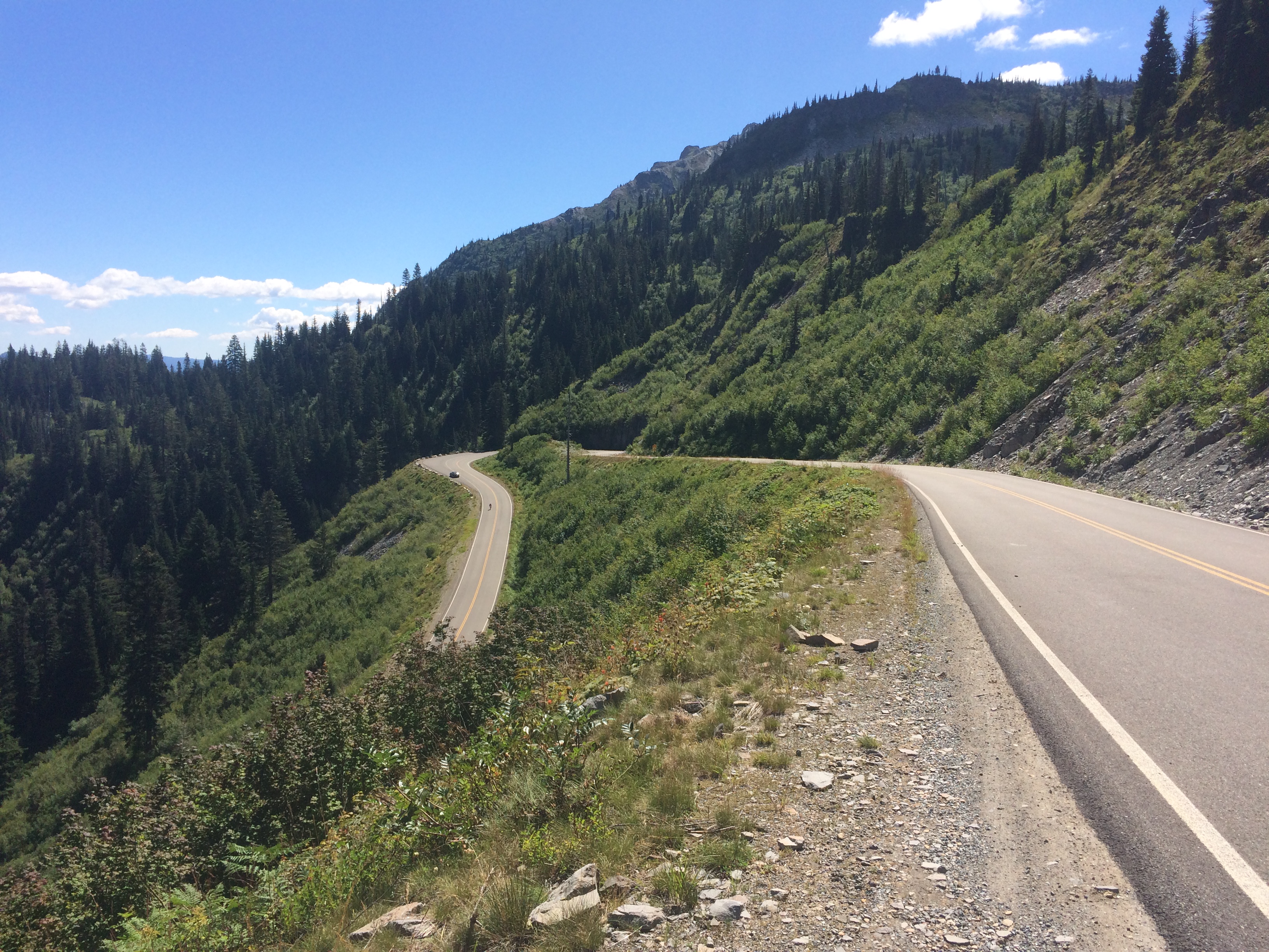
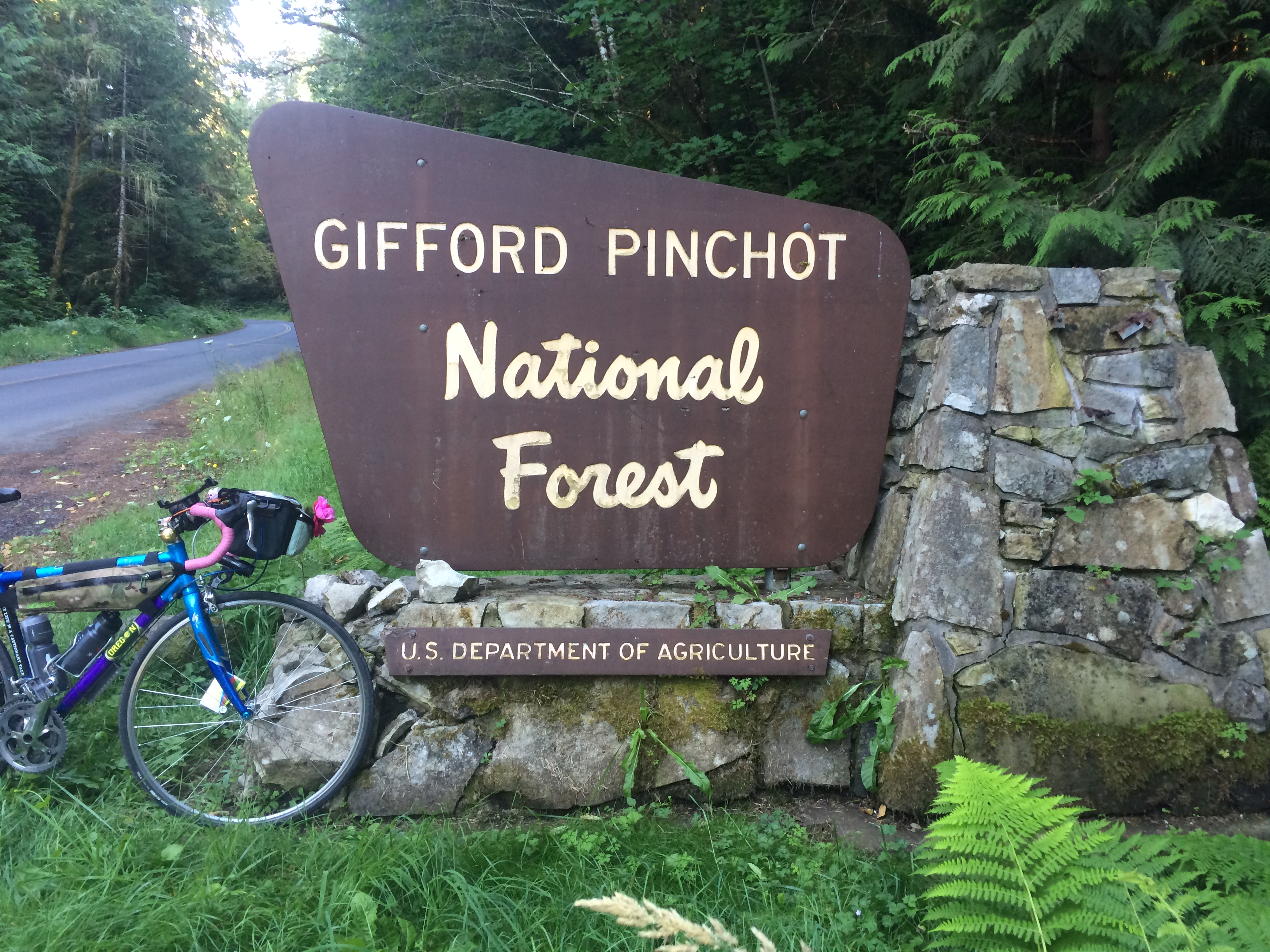
For heading down from Paradise, out of Mount Rainier National Park, and into Gifford Pinchot National Forest, Brad took us on a great forest road/service road/dirt road cut-through he’d ridden before. It led to the lovely Skate Creek Road, which is apparently Jan Heine’s (randonneur extraordinaire) favorite road. So while bike touring with a randonneur will make the miles and elevation really add up, it can lead to some great stuff. It also led to us finding our way to Cline Road to avoid busy highway 12 which was quiet with a few rolling hills, but we were chased by four dogs! So now I’m scared of farm dogs. Granted, one of those dogs was a tiny Yorkie.

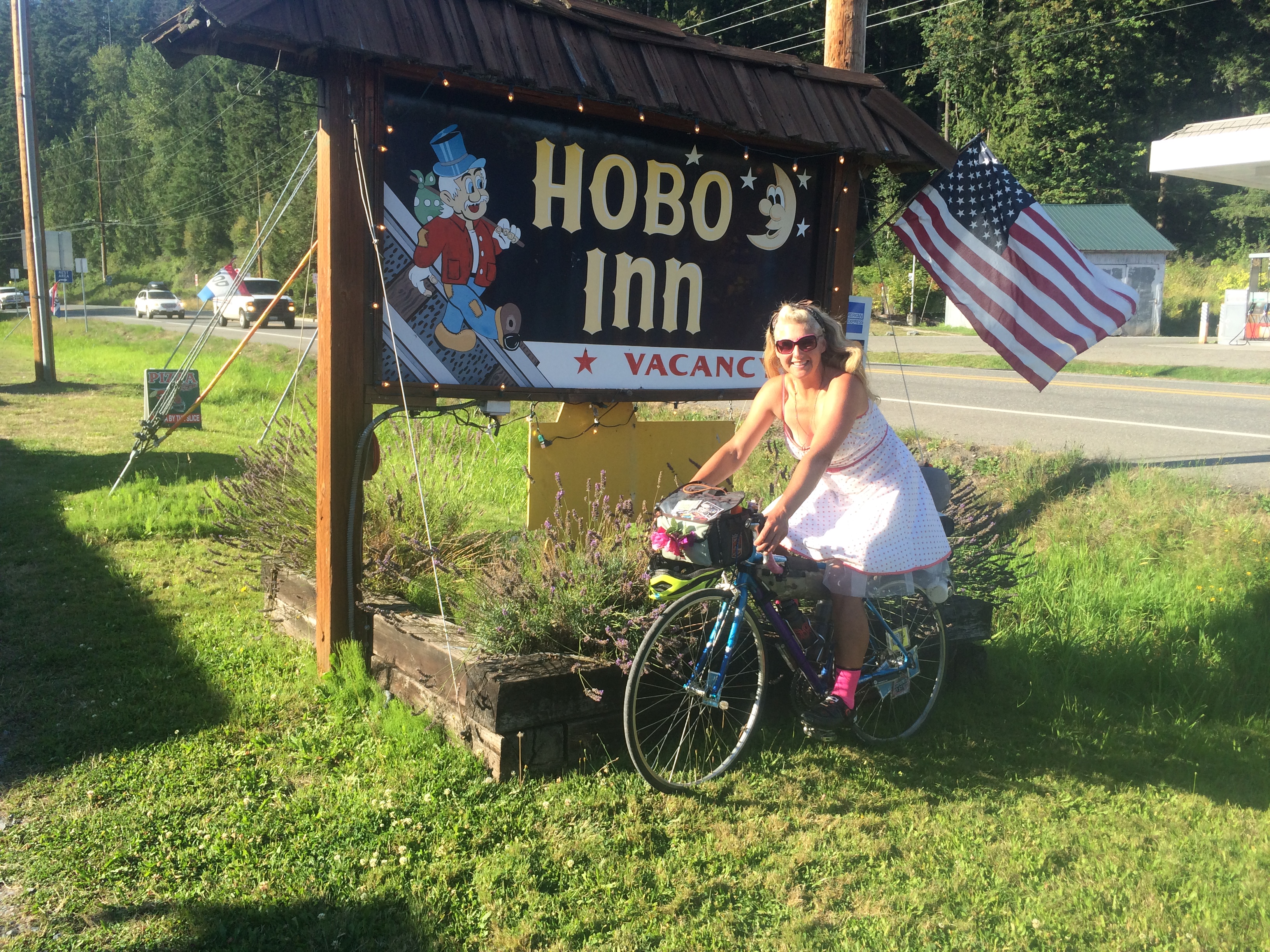
We stopped for lunch in Packwood and while stocking up for dinner and breakfast at the grocery store, a guy confided in us that the town is run by elk. I was kind of relieved to hear that because it explained all the NO SHOOTING signs. He said they know exactly where the signs are and keep on the right side of them. And when he has to open the pizza place early in the morning it often takes him an extra half hour because they’ll block his car in the middle of the road and only move aside when they’re ready. Brad didn’t seem convinced, but I’ve had a healthy fear of elk since I was a kid camping in Oregon and Washington and took the warnings to stay away from elk because they’re assholes (that might not have been the exact word the park rangers used) very seriously.
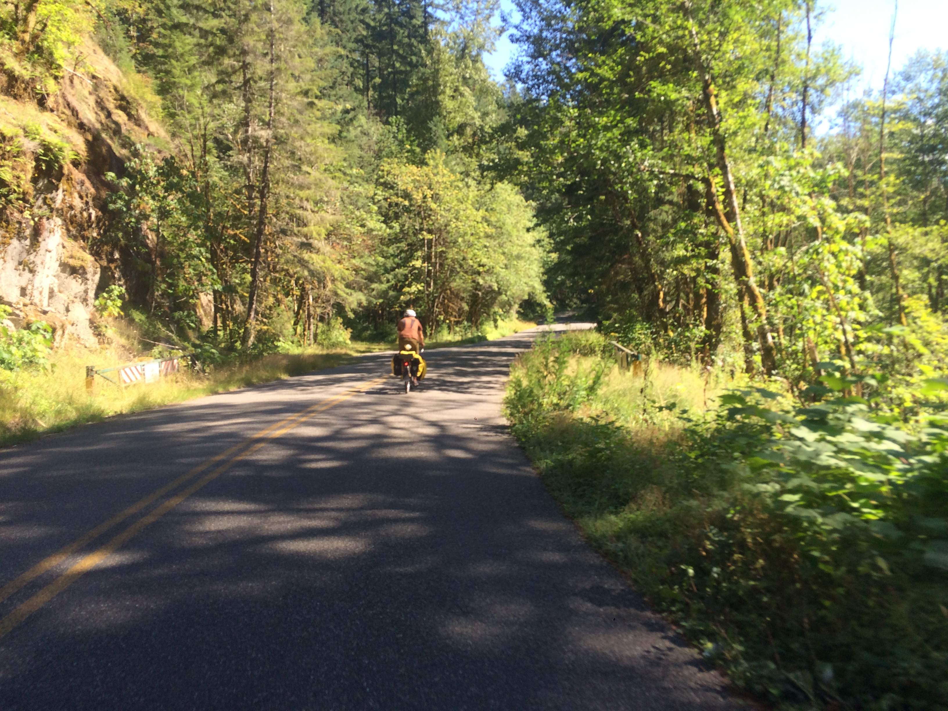
It was late by the time we got into the Gifford Pinchot National Forest. I’m not sure if it was the result of the long day of biking or if the grades of routes 25 and 99 were really steep, but I had to slalom back and forth to get up the hills. It was too dark to see Mount St Helens, but the clear sky and half moon meant we had a terrific view of shooting stars from the Perseid meteor shower.
Day Three:
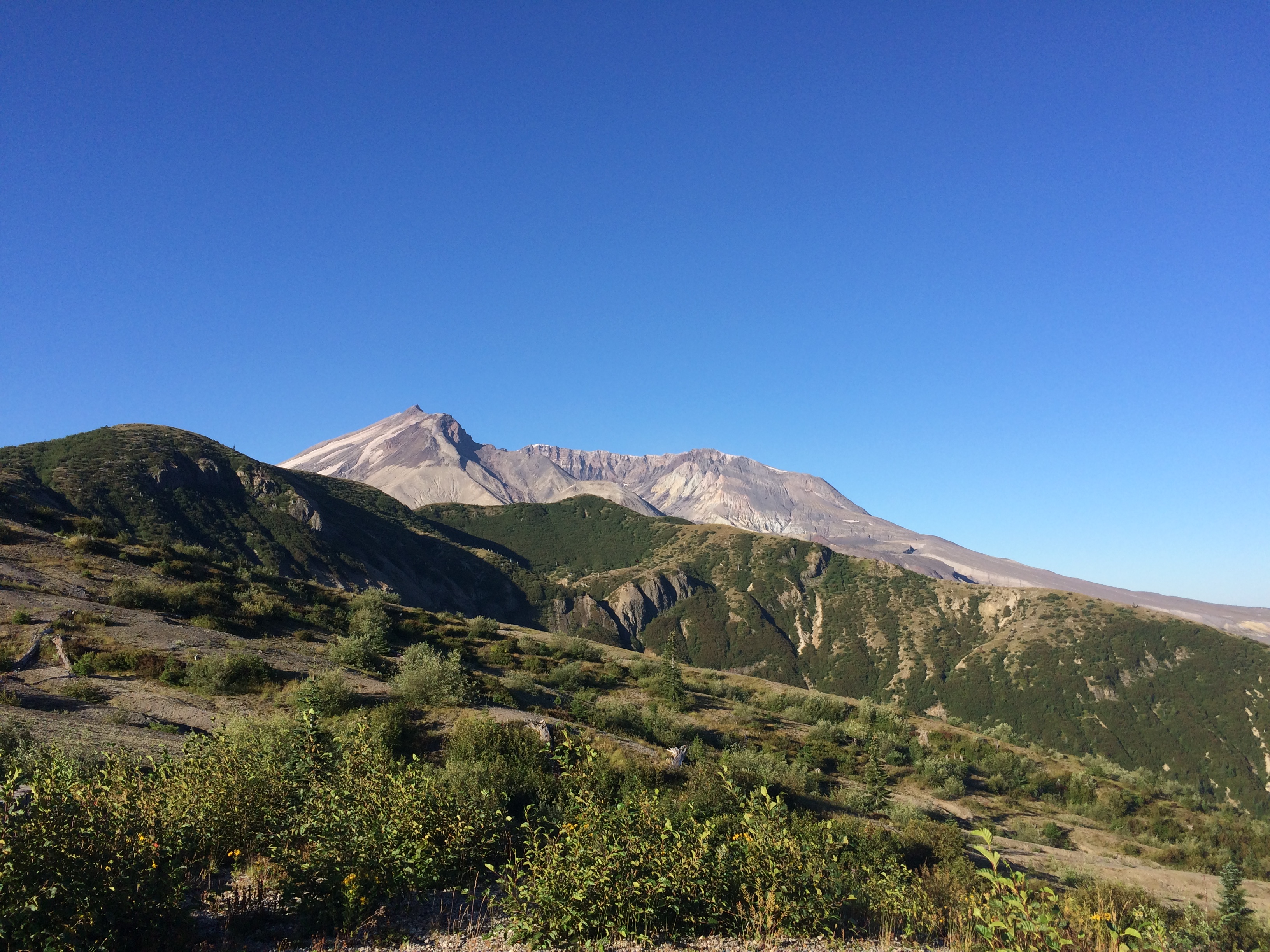
Getting to see Mount St Helens and view the distinct flora (and lack thereof) of the blast zone in all directions in the morning was amazing. We met a few people setting up an aid station for the Bigfoot 200 Mile Endurance Run along the Truman Trail at the Windy Ridge Viewpoint. Oof, I can’t even imagine.

Even with our less strenuous day planned, I was having trouble finding my groove. It may have been the two big days in a row, or having spent almost 12 hours in the saddle on day two, or something else (or all three!), but even on the descents I was moving slowly. After many sluggish hours, we stopped for lunch in Elbe at the Mt. Rainier Railroad Dining Company and that fixed everything. Elbe is also a place I’ve been to before, but only by car.

We didn’t have a set plan for days three and four, but were tentatively thinking about aiming for Orting where we’d either have to pay for a hotel or “free camp” (a term we learned from some nice bike tourers we met on highway 12 or 7…it was before lunch so I can’t remember where we were). Somewhere along the way we realized we could make it all the way home a day early, most easily done if we caught the bus again. Sound Transit 578 starts in Puyallup, but Sumner was closest to us if we could make it there by 9:19 p.m. So I rallied and we picked up the pace and we arrived to Sumner Station at 9:03–a whopping 16 minutes early to snack and unload our bikes. This bus also had a two-bike rack, but the driver told us the last bus of the night will allow excess bikes inside.
En route to Sumner I recognized Orting from having passed through in the other direction during Swift Campout. We raced along the Foothills Trail, though not as fast as the world’s fastest ElliptiGO rider (stepper?). He slowed his roll for a bit to chat with us. Turns out he’s doing the High Pass Challenge (a ride from Packwood up Windy Ridge–where we just were!) and will probably be way faster than a lot of the bike riders.

Ta da!
318.5 total miles (adding in my Seattle miles on either side)
21,313 feet climbed (not adding in my Seattle elevation because I didn’t Strava that and don’t know how to calculate it easily)
Aches and pains:
I wish I’d brought my fingerless gloves along because by day two I was getting a bit of chafing on the sides of my forefingers where they rested against the hoods of my drop bars. I bought the gloves for biking the McKenzie Pass while visiting Eugene in May, but didn’t need them, nor did I use them for biking from Seattle to Portland shortly after that. So it didn’t occur to me to bring then on this trip. I ended up with a blister on the heel of one hand by the end of day three, but it wasn’t painful.
And I got “hot foot” (a fancy term for an achy foot from being trapped in a tight cycling shoe all day) halfway through day three, but stopping for lunch and taking my shoes off while eating meant I could make it through the rest of the day relatively discomfort free.
Donate to parks and forests
In addition to having a tremendous time in Mount Rainier National Park and the Gifford Pinchot National Forest, we did so very cheaply. We arrived too late to pay one entrance fee and a nice park ranger decided to waive our fee at another gate. So I settled up by donating, both to Washington’s National Park Fund (WNPF)–you can select the specific park–and the National Forest Foundation–you can’t select which forest, but you get to see how many trees your donation will plant.